In light of the COVID-19 pandemic, be aware that public areas such as restrooms and picnic areas may be closed.
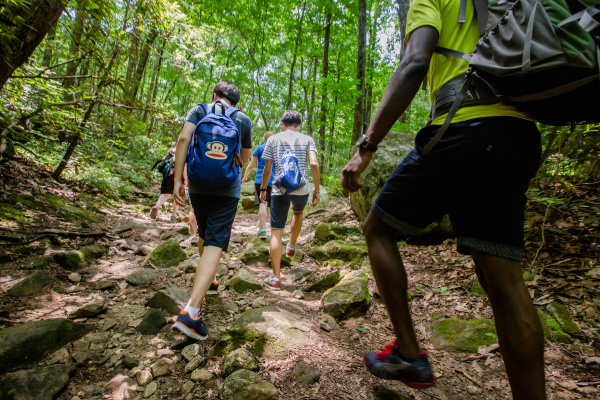
Visiting scenic views in the Blue Ridge Mountains and Foothills is a popular outing for people around Greenville. You could spend an afternoon at choice spots in South Carolina or take a day to experience views in North Carolina. Selected from many options, each of the following locations rewards visitors for the time spent driving there.
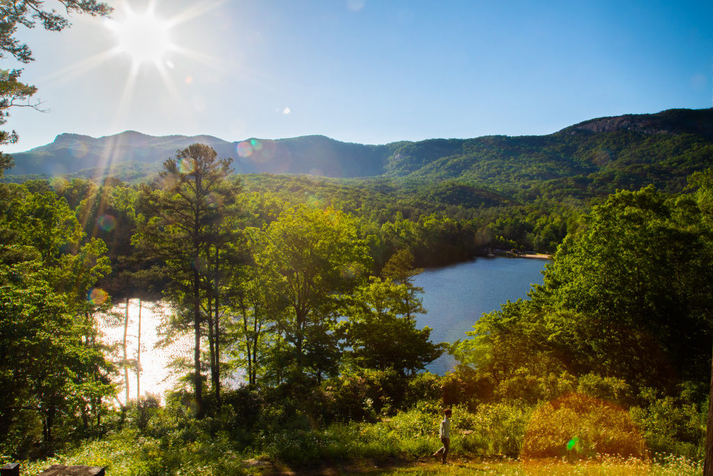
Bald Rock

Bald Rock attracts scenic view enthusiasts because of its unobstructed views. Overlooking the Blue Ridge Foothills of Greenville and Pickens Counties, Bald Rock also offers a view of Table Rock rising from the right. The large flat surface area allows multiple groups to enjoy the view at a distance from others and the edge.
Although Bald Rock is bare, forest on either side provides the perfect spot for hammocking after a sunrise or before a sunset.
A small parking lot and wooden footbridge off the side of the road mark the attraction. From the parking lot, a short walk across the footbridge leads directly to the views.
Caesars Head Overlook
Five miles up the road from Bald Rock, the Caesars Head State Park Visitor Center provides direct access to the Caesars Head Overlook. After walking .3 miles from the parking lot along a fenced boardwalk shaded by trees, visitors arrive at the rocky peak of the Blue Ridge Escarpment. The view is breathtaking. On a clear day, even parts of North Carolina and Georgia are visible. Included in the panorama are
- Campbell Mountain
- Paris Mountain State Park
- Glassy Mountain
- Stool Mountain
- Pinnacle Mountain
- Dismal Forest
- Raven Cliff Mountain
- Table Rock Mountain and Reservoir
No wonder this scenic view is a popular engagement site.

See Also: Around Greenville: S.C. State Parks
Pretty Place
The Fred W. Symmes Chapel, commonly called Pretty Place, offers a stunning view of the foothills at the edge of Upstate South Carolina. In front of the rolling blue-green hills, the silhouetted cross fills viewers with reverence and awe of the Creator.
Built in 1941, the chapel primarily hosts summer worship services of the YMCA Camp Greenville, to which Symmes gave the chapel. But when the chapel is not hosting camp or private events, the public is welcome to visit. Events happen year-round, so Camp Greenville provides a visitation schedule that informs visitors of times they can go during daylight. A parking lot provides ample room for guests.
Jumping Off Rock Overlook
Combining mountains with a lake enhances scenic views, and Jumping Off Rock Overlook on Horse Pasture Road is no exception. After driving up the bumpy, winding gravel road, park on the side of the road and take the easy .1-mile path to the spacious overlook. From there, anyone can enjoy a bird’s eye view of Lake Jocassee and the mountains of western North Carolina.
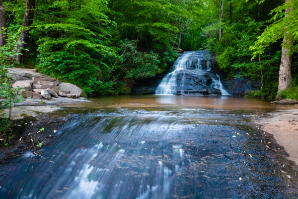
Although Horse Pasture Road is open to cars year-round, people can also hike on the road. The road can be steep, but it rewards hikers with small waterfalls and several other overlooks along the way. Boot Leg Road, sometimes open to cars, leads to a beach area at the lake.
Blue Ridge Parkway

Scenic views line the entire Blue Ridge Parkway, and the many overlooks offer places to park and enjoy the mountains. But for those who enjoy off-road views, overlooks on trails adjacent to the Parkway also feature stunning views. Here are a few for starters.
Black Balsam Knob and Tennent Mountain
At Milepost 420, Black Balsam Knob Road leads to the Art Loeb Trail, a hike across Black Balsam Knob and Tennent Mountain. Except where tall shrubbery lines the path, the bare mountains offer unobstructed scenic views of the surrounding landscape plus 360-degree views at the peaks.
The trail alternates between moderately steep inclines and rocky descents. If looped into Ivestor Gap Trail, the hike is 5 miles, but anyone can turn back after reaching either summit.
Devil’s Courthouse
Just down the road from Black Balsam Knob at Milepost 422.4 is Devil’s Courthouse. The parking lot overlooks the outcrop, and the .5-mile Devil’s Courthouse Trail leads to the walled-off summit with a 360-degree view of rolling hills from North Carolina, South Carolina, Georgia and Tennessee. The trail is somewhat strenuous, but most of it, including the steepest parts, are paved.
Waterrock Knob and Browning Knob
At Milepost 451.2, a short road from the Parkway arrives at a large parking lot and the Waterrock Knob Visitor Center, open mid-April through October. The parking area offers multiple views, but the best view is at the summit, accessed by Waterrock Knob Trail. The first half of the steep out-and-back .5-mile trail is paved. An overlook with a stone wall precedes the flat summit of Waterrock Knob at the end of the trail.
Fifty feet below the summit, an unmarked trail leads to Browning Knob. Less frequented, this rugged trail uses yellow dots to mark the way to the wreckage of a Cessna 414. On November 24, 1983, the plane, occupied by two pilots, was headed toward the Jackson County Airport in North Carolina. But before it arrived, it crashed into Browning Knob, most likely due to low visibility from rainy weather. The crash was fatal to both pilots.
Ambitious hikers wanting more views can continue the moderate to strenuous hike over Browning Knob to the Lyn Lowry Memorial Cross.
Craggy Pinnacle
At Milepost 364, the Craggy Dome Overlook by Craggy Gardens is the starting point of the .7 mile Craggy Pinnacle Trail. A fork in the path leads to an upper and lower overlook. Both are lined with stone walls, but only the upper overlook has a 360-degree view. There are also spur trails at the summit. The moderate hike up the well-maintained trail is a total of 1.4 miles. It is most popular when the blooming rhododendrons create a tunnel from late May to mid-June.
Rough Ridge Lookout
At Milepost 302.8, a parking lot provides an entrance to the easy to moderate Tanawha Trail, which extends a total of 13.5 miles parallel to the Blue Ridge Parkway. This access point leads directly to Rough Ridge Lookout, one of the most popular spots on the trail. Across the wooden bridge and along the boardwalk, visitors can enjoy views .3 miles from the parking lot. The moderate uphill trail continues to the rocky summit, .8 miles from the parking lot. There, cables lead to the top of Rough Ridge.
Not only do people visit because of the boulders that create a rustic setting for pictures, they also visit for free views of Grandfather Mountain and the Linn Cove Viaduct.
By entering Grandfather Mountain State Park through the entrance gate, hikers can view the mountain from the Mile High Swinging Bridge on Linville Peak and hike the Grandfather Mountain Trail. However, those activities require admission: $22 for adults, $18 for seniors and $9 for children under 13.